Hamid Karzai International Airport (Hamid Karzai International Airport)
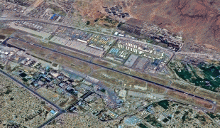
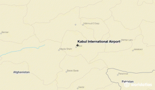
Kabul International Airport (known as Hamid Karzai International Airport from 2014 to 2021; ), also known as Kabul Airport, is located about 5 km from the center of Kabul in Afghanistan. It is owned by the Government of Afghanistan and operated by UAE-based GAAC Holding on behalf of the Ministry of Transport and Civil Aviation. It serves as one of the nation's main international airports, capable of housing over one hundred aircraft. It was locally named as Khwaja Rawash Airport. The airport was renamed in 2014 in honor of former President Hamid Karzai. The decision was made by the National Assembly of Afghanistan and the Cabinet of the then President Ashraf Ghani. It was given its current name in 2021 by the Taliban.
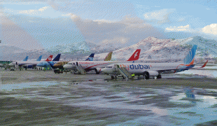
Opened in 1960, the airport has been the primary gateway to Afghanistan and is located at high altitude, surrounded by the mountains of the Hindu Kush. For many years it has been the base of Ariana Afghan Airlines and Kam Air. A new international terminal was opened in the 2000s and at the time a number of military bases were also built around the airport, which were used by the United States Armed Forces and NATO's International Security Assistance Force (ISAF), and later the Resolute Support Mission (RS). The Afghan Air Force also had a base there, while the Afghan National Police provided security inside the passenger terminals. Prior to the withdrawal of NATO's military forces in mid-2021, the airport provided scheduled flights to and from Pakistan, India, Iran, China, Turkey, Russia, Uzbekistan, Tajikistan, and the Arab Gulf states. As of June 2016, the most frequently serviced destination from the airport was Dubai in the UAE, with no fewer than four passenger airlines flying the route, and some with multiple daily flights.
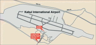
After the evacuation of NATO's forces on August 31, 2021, all civilian flights were canceled and suspended until further notice. A week before that the airport's Abbey Gate had been attacked in a suicide bombing by Islamic State – Khorasan Province (ISIS-K). Following the Taliban takeover, the airport was closed to the public for about a week. On September 26, the Taliban announced that the resulting debris at the airport had been cleaned up, and asked international airlines to resume flights.
Kabul Airport was originally built in 1960 by Soviet engineers. The airport was locally named Khwaja Rawash Airport. Foreign tourists began visiting Afghanistan via Kabul Airport. This era ended after the 1978 Saur Revolution, especially after the 1979 Soviet invasion.
The airport was used by the Soviet Army during the Soviet–Afghan War from 1979 to 1989, and by the military forces of the former President of Afghanistan, Mohammad Najibullah. Control of the airport switched between different sides during the civil war after 1992. By November 1996, the Islamic Emirate of Afghanistan governed by Mullah Muhammad Omar was in possession of the airport, until late 2001 when they fled the city after the U.S. invasion of Afghanistan. Due to international sanctions during the Taliban government, the airport was closed in the late 1990s, with very limited international flights.
Following the U.S. invasion of Afghanistan after the September 11, 2001 attacks, Kabul Airport was bombed by United States and coalition forces. After the International Security Assistance Force (ISAF) took over control, the airport began to be developed slowly over the years. A new radar system was installed in 2005, which was upgraded by the U.S. Federal Aviation Administration in 2010.
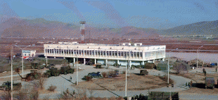
A new $35 million terminal for international flights was inaugurated in November 2008, built with aid from the Japan International Cooperation Agency. The then-Afghan President Hamid Karzai attended the inauguration ceremony. The new terminal was officially opened to international flights in June 2009. The existing terminal has been refurbished and used for domestic flights. Passenger movements reached 100,000 per year by 2010 or 300 per day. In early 2012, the radar system was upgraded to cover Afghanistan's entire air space.
In October 2014, the National Assembly of Afghanistan proposed naming the airport after former Afghan President Hamid Karzai, a month after his tenure ended, in recognition of his services and contributions to the country's rebuilding. This decision was approved by the Cabinet of the new President Ashraf Ghani, which renamed the structure as Hamid Karzai International Airport.
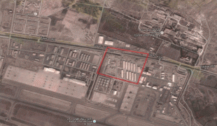
The North Side Cantonment – Kabul Airport facility was completed and turned over to the United States Armed Forces in October 2008. It houses the command facilities for the Afghan Air Force (AAF), and includes housing, administrative, operations, maintenance and recreation facilities. The project included two new hangar complexes, a new taxiway and ramps. It is the headquarters and main base (1st or 201st Wing) of the Afghan Air Force. The first hangar facility was turned over to the AAF in January 2008. The second hangar was completed later that year.
| IATA Code | KBL | ICAO Code | OAKB | FAA Code | |
|---|---|---|---|---|---|
| Telephone | Fax | ||||
| Home page |
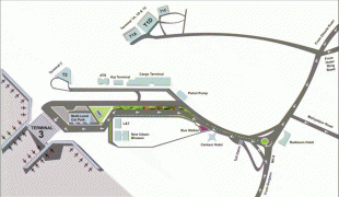
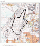
Map - Hamid Karzai International Airport (Hamid Karzai International Airport)
Map
Country - Afghanistan
 |
 |
| Flag of Afghanistan | |
Human habitation in Afghanistan dates back to the Middle Paleolithic era, and the country's strategic location along the historic Silk Road has led it to being described, picturesquely, as the ‘roundabout of the ancient world’. Popularly referred to as the graveyard of empires, the land has historically been home to various peoples and has witnessed numerous military campaigns, including those by the Persians, Alexander the Great, the Maurya Empire, Arab Muslims, the Mongols, the British, the Soviet Union, and most recently by a US-led coalition. Afghanistan also served as the source from which the Greco-Bactrians and the Mughals, amongst others, rose to form major empires. The various conquests and periods in both the Iranian and Indian cultural spheres made the area a center for Zoroastrianism, Buddhism, Hinduism, and later Islam throughout history.
Currency / Language
| ISO | Currency | Symbol | Significant figures |
|---|---|---|---|
| AFN | Afghan afghani | Ø‹ | 2 |
| ISO | Language |
|---|---|
| PS | Pashto language |
| FA | Persian language |
| TK | Turkmen language |
| UZ | Uzbek language |


